")
GENERAL PRESENTATION OF THE WILAYA

Ghardaïa is located at the center of the Northern part of the Sahara. Result of the administrative division of the Algerian territory on 1984.
Wilaya of Ghardaïa is limited:
In North by Wilaya of Laghouat (200 km);
In North East by Wilaya of Djelfa (300 km);
In the East by Wilaya of Ouargla (200 km);
In the South by Wilaya of Tamanrasset (1,470 km);
In South-west by Wilaya of Adrar (400 km);
In the West by Wilaya of El-Bayadh (350 km).
Ghardaia covers a surface of 86,560 km2 being distributed as follows:
It is characterized by plains in the Terminal Continental, of the sandy areas, the Chebka and the whole of the central region and extend from North in the South on approximately 450 km and, it Is in West on approximately 200 km.
The rock Escarpments and the oases determine the landscape in which the cities of the pentapole of Me Zab are localised and around of which revolve other oases (Berriane, Guerrara, Zelfana, Metlili and much more far in the South El-Ménéa).
GEOGRAPHICALOUTLINEOFTHEWILAYAOFGHARDAÏA
PHYSICAL DATA
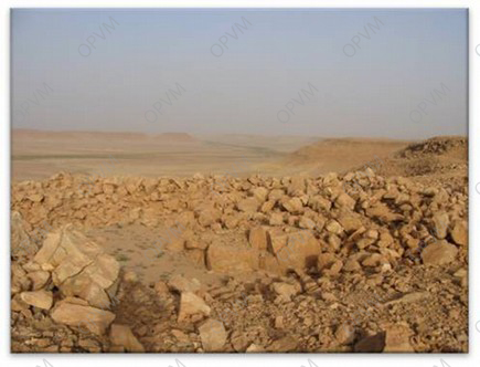
The geomorphologic unit on which the M’zab valley stands is a rock plate, the HAMADA, the landscape is characterized by a vast stony extent where a naked rock of brown and blackish color levels.
This plate was masked by strong fluvial erosion of the early Quaternary that cut in its southern part of the flat-topped hills and formed valleys. The unit names the CHEBKA “Net” because of the tangle of its valleys. The M’ Zab valley crosses this net of 38,000 km2 of the North-West towards South-east.
The Me Zab valley reached the height of GHARDAIA, an altitude of 500 meters. It is in the hollow of the M’Zab valley, on rock pitons, that set up the pentapole. Each of these five (05) quoted is surrounded by hills gullied by rain erosion.
CLIMATOLOGY
The climate of the wilaya of Ghardaïa as in the other areas of the Sahara is characterized by summers with torrid heats and soft winters.
Pluviometry:
Precipitations are very weak and irregular. In Ghardaia, they vary between 13 and 68 mm over fifteen (15) days average duration a year.
The temperature:
The hot period starts in May and lasts until September.The average temperature recorded in July is of 36.3°C, the absolute maximum of this period reached 47 °C. For wintery time, the average temperature recorded in January does not exceed 9.2 °C, the absolute minimum of this period reached -1 °C.
Winds:
For certain periods of the year, in general in March and April.
The sand winds are very frequent in the area of El-Ménéa especially during spring, April, May and June.
As regards the Sirocco, in the zone of GHARDAIA , we can note an annual average of 11 days/ a year, for the period going from May to September.
Partager cet article: